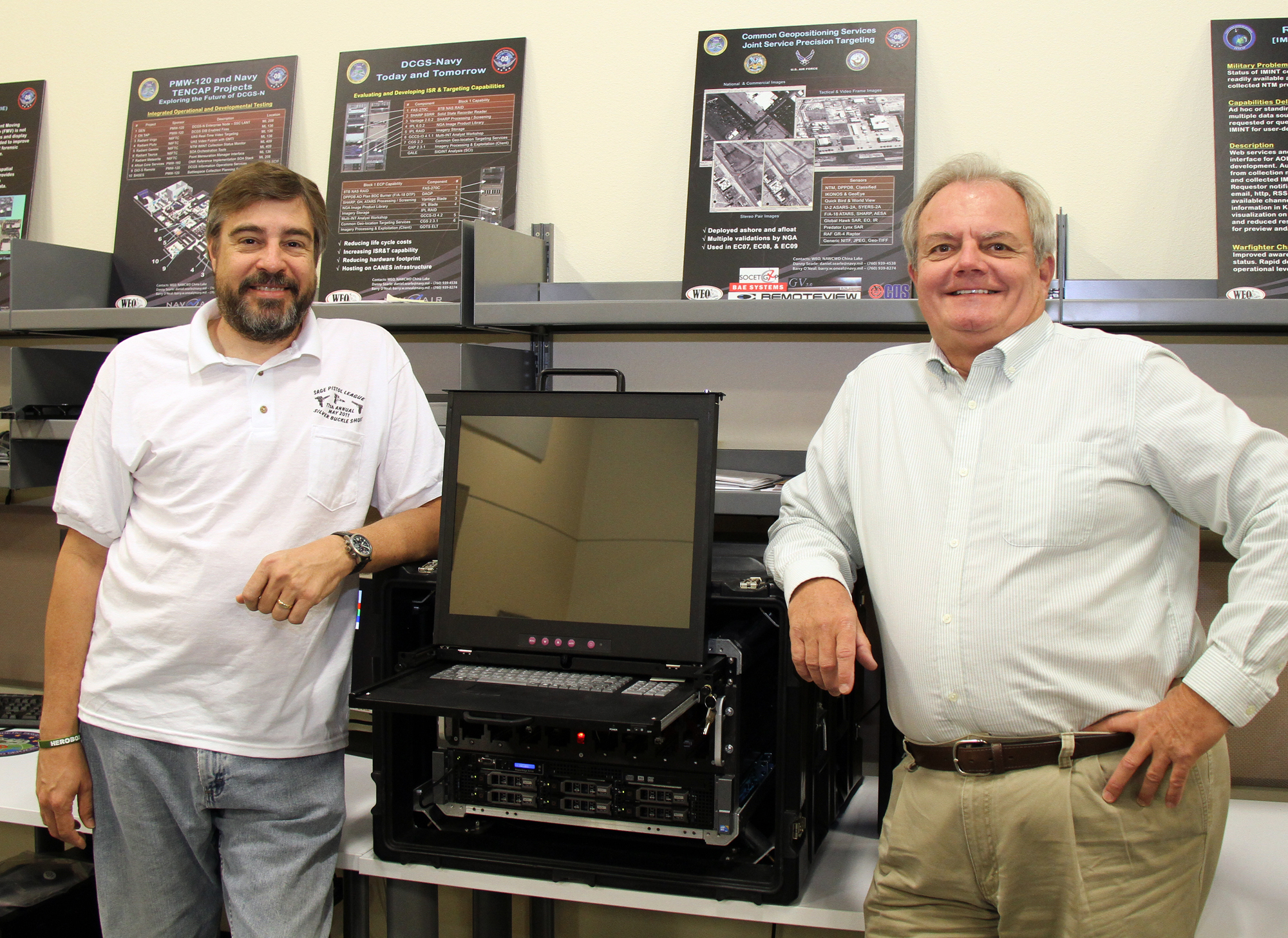
At left, Erik van Bronkhorst, NAWCWD Information Technology developer, and Barry W. O’Neal, technical lead of ISR & Targeting Projects, stand beside the Portable Geospatial Products Library, affectionately dubbed the “Whopper,” that recently deployed with the USS Carl Vinson. (U.S. Navy photo)
NAWCWD ISR & Targeting Projects answers Fleet distress call, delivers a "Whopper"
CHINA LAKE, Calif. – When Capt. Stephen Roberts, staff intelligence officer (N2) at the Naval Strike and Air Warfare Center (NSAWC), Fallon, Nev., learned that during rehabilitation of the Carrier Intelligence Center (CVIC) spaces aboard the USS Carl Vinson (CVN 70) that everything had been stripped out, he sounded the alarm. Roberts phoned his NAWCWD targeting resource Barry O’Neal, technical lead of ISR & Targeting Projects. The intelligence processing and exploitation systems needed to support CVW-17 mission planning had not been updated with the latest Distributed Common Ground System – Navy (DCGS-N) equipment. Instead, the ship would now have to rely on the ten-year-old Joint Service Image Processing System – Navy (JSIPS-N) and the, even older, Precision Targeting Workstation (PTW) systems, which only had one terabyte of storage available for imagery and targeting products.
The mission planning process afloat is dependent upon overhead imagery and digital targeting products that the Navy receives from the National Geospatial-Intelligence Agency (NGA). These data products are used to plan strike missions with Joint Direct Attack Munition (JDAM), Joint Stand Off Weapon (JSOW) and Standoff Land Attack Missile-Expanded Response (SLAM-ER) weapons. In addition, they are needed on a daily basis for F/A-18 SHARP reconnaissance mission route planning, threat avoidance, target area analysis and ground-truth reference for intelligence. Because these products are so detailed, they are also quite large in terms of data volume; several terabytes of files are needed to cover a typical F/A-18 mission area. CVW-17 would need about 35TB of storage.
NAWCWD employees scrambled to assist. Information Technology (IT) engineer, Spencer Hall, defined the hardware solution and initiated the IT Approval Process. IT developer, Erik van Bronkhorst, designed transit cases and procured power supplies with battery backup. Rick Toal sent blank 2TB drives to NGA with an urgent request to have them filled with the needed data. They had eight weeks to pull something together and about a 50-50 shot at making the deadline.
Data loading began in early November. Hall loaded software on the server, both Linux and Windows. One of the two Redundant Array of Independent Discs (RAID) racks was in place and its lights were blinking, indicating data transfer.
The transit cases had arrived but needed to be modified to keep the equipment from falling out. Using limited resources, van Bronkhorst designed and applied the modifications. By the end of November, he completed the final modifications that would “keep things from flopping around.” Even though there were still a lot of pieces and stuff lying around the laboratory, van Bronkhorst assured O’Neal, “We can slap this baby together in no time.”
On November 28, production ended. Hall and van Bronkhorst packed up the system they named the Portable Geospatial Products Library, (PGPL) and headed to NAS North Island for the USS Carl Vinson to meet Lt. Cmdr. James Brennan and his CVW-17 team.
O’Neal stated, “The PGPL consisted of two 200-plus pound transit cases, but Brennan had promised to “get the beast aboard the boat” if we got it there. I later heard it took eight people took to push those cases up three ladders and through the bulkheads into the CVIC spaces.”
When they powered it up, Hall and van Bronkhorst only had a few hours to show the CVW-17 N2-types how to use it before the NGA rep showed up to inspect and certify their mission planning and targeting capability. The USS Carl Vinson sailed on schedule and the PGPL was now a “deployed” system. PGPL contained almost all of the maps, charts, controlled image base (CIB), and Digital Point Positioning Database (DPPDB) products needed for the missions CVW-17 would conduct in both the 5th and 7th Fleet areas of responsibility (AORs) during the cruise. The total data load was about 30TB -- more than any previous air wing has had access to while on cruise.
NAWCWD reservist Capt. Patrick “Father” Mulcahy flew out to the ship and delivered a laptop loaded with Common Geo-positioning Services (CGS) targeting software. Mulcahy reported that the CGS training went very well and that the “WOPR” (pronounced whop-per -- their call sign for the PGPL, based on a super duper computer in an old sci-fi movie, "War Games") was a big hit with the air wing and all the folks in CVIC.
Summarizing the monumental task, O’Neal said, “We all felt good about helping our warfighters when they called upon us. Hall and van Bronkhorst created the PGPL; Toal secured the data; Sandy Gamble and Diane Tilley handled the security paperwork; James Dack got the best computer gear in record time, and Mulcahy trained the crew. Without this incredible team effort, the PGPL system would not have been aboard the USS Carl Vinson as it sailed and its aircraft flew in harm’s way.”
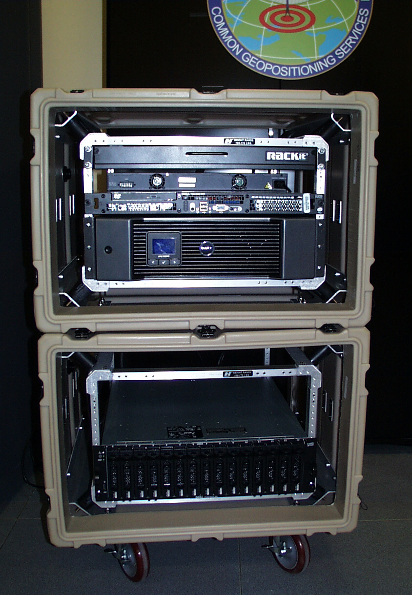
The Portable Geospatial Products Library (PGPL), aka "Whopper," deployed with the USS Carl Vinson in December 2010. The PGPL held more than 30 terabytes of targeting data. (U.S. Navy photo)